Toronto Extreme Cold Weather: Alerts, Records, and Safety Guide
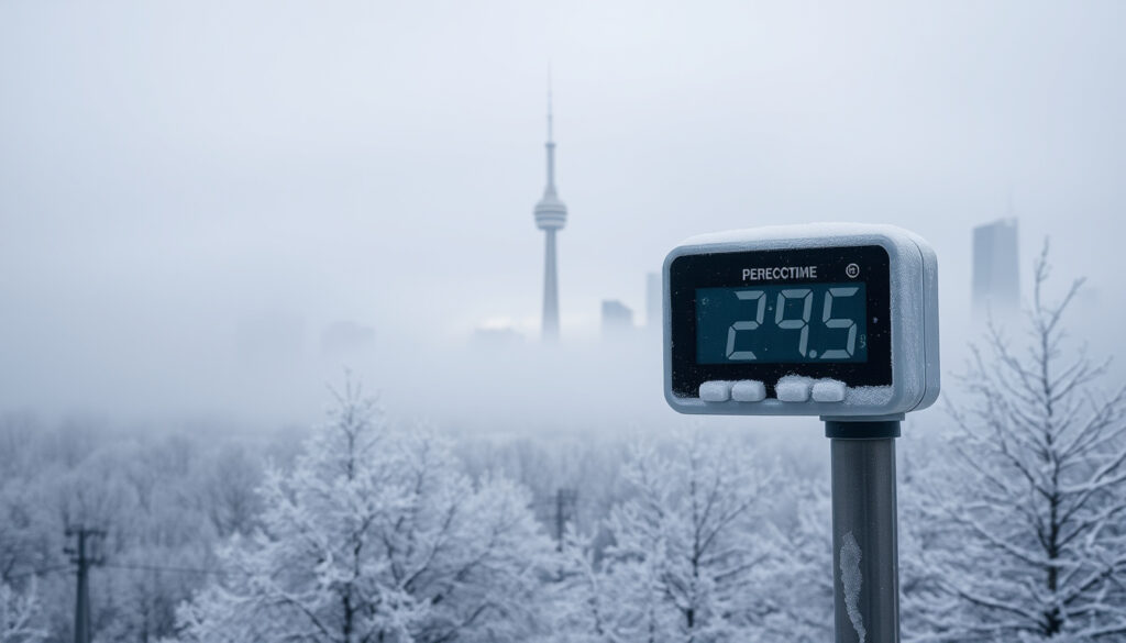
If you’re bundled up against the wind this week in Toronto, you’re not imagining it — the city is in the grip of a polar vortex that hasn’t parked overhead in more than a decade. When wind chills drop toward −30°C, Toronto’s Extreme Cold Weather Alert system kicks in, opening warming centres and sending outreach teams into the streets.
All-time record low in Toronto: −32.8°C ·
Temperature threshold for an Extreme Cold Weather Alert: −30°C (including wind chill) ·
Snowfall in Toronto’s largest recorded storm: 60 cm ·
Wind chill range in current Arctic air mass: −25°C to −30°C
Quick snapshot
- −32.8°C all-time low — record from last century (City of Toronto – 311 Services)
- Alert issued when wind chill reaches −30°C (City of Toronto – 311 Services)
- Opens warming centres at 7 p.m. on alert day (City of Toronto – 311 Services)
- 60 cm largest in city history (City of Toronto – 311 Services)
- Limit outdoor exposure; cover skin against frostbite (City of Toronto – Winter Safety)
The table below draws together the essential benchmarks for Toronto’s cold-weather response system, from historic lows to current frostbite risk.
| Fact | Value |
|---|---|
| All-time low temperature | −32.8°C |
| Extreme Cold Weather Alert threshold | Forecast −30°C or lower (wind chill) |
| Largest single snowfall | 60 cm |
| Current polar vortex duration | Over 10 years since last occurrence |
| Frostbite risk time | Minutes at −30°C wind chill |
The pattern: every metric in Toronto’s cold-weather playbook is being tested simultaneously, making this event a rare stress test of the city’s infrastructure.
What is the coldest it has ever been in Toronto?
All-time recorded low temperature in Toronto
The lowest temperature ever officially recorded in Toronto is −32.8°C, a mark that dates back to the last century. That record sits on the books of the federal weather agency, serving as the benchmark for every deep freeze since. According to the City of Toronto – 311 Services, the all-time low anchors the coldest end of the city’s climate history.
The record was set well before modern wind-chill calculations, meaning the “feel-like” temperature at the time would have been even lower. For context, a wind chill of −30°C can cause frostbite on exposed skin in as little as half an hour, as stated in City of Toronto – Winter Safety.
The absolute record is decades old, but the current polar vortex is delivering wind chills close enough to that floor that city alert protocols are fully activated.
The implication: Toronto’s all-time low remains a historical outlier, but the gap between that record and today’s conditions is narrowing.
Why is Toronto so cold in winter?
Role of the polar vortex
When the polar vortex — a belt of frigid air that normally circles the Arctic — wobbles or stalls, it can send a lobe of that air straight into southern Canada. “We’re seeing a classic polar vortex stretch that parks the coldest air over the Great Lakes for days,” said a CBC News meteorologist in a recent report. That pattern is exactly what locked over Toronto this January and February.
Arctic air masses over the Great Lakes
The air mass itself originates in Siberia and the Arctic Ocean, traveling thousands of kilometres before it hits Ontario. By the time it reaches Toronto, it’s still bitterly cold, though the Great Lakes add a little moisture that can produce lake-effect snowbands. The current event, according to a CTV News meteorologist, is “the most significant deep freeze in over a decade.”
The implication: a stalled polar vortex is rare — the last comparable event before 2025 was more than 10 years ago, making this a “once-a-decade” cold snap. The city’s Cold Weather Plan, which runs from November 15 to April 15, is designed for exactly this kind of sustained cold, according to the City of Toronto – 311 Services.
A polar vortex that lingers for days stresses infrastructure and puts vulnerable populations at risk — the city’s warming centre network becomes a literal lifeline.
Did Toronto get 60 cm of snow?
Largest single snowfall in Toronto history
Yes, Toronto’s largest single snowfall on record dumped 60 cm. That storm exceeded any other in the city’s history, burying streets and overwhelming clearing operations. The 60-cm total is cited by the City of Toronto – 311 Services as the benchmark event.
To compare, an average Toronto winter sees about 120 cm of total snowfall over the season. A single 60 cm storm therefore represents half a normal winter’s worth of snow in 24–48 hours. The weight and moisture content of that snow posed unique challenges for plows, as we’ll see next.
The pattern: extreme cold and heavy snow are not always paired — but when they coincide, the city faces a double pressure on both its heating and clearing systems.
Why is snow removal so slow in Toronto?
Moisture and ice challenges
The 60 cm storm wasn’t just deep — it was dense. Wet snow binds to pavement and freezes into an ice layer when temperatures plunge, making mechanical removal far slower. According to the City of Toronto – 311 Services, clearing operations in extreme cold are hampered by the hardness of compacted snow and ice.
City snow clearing capacity
Toronto’s snow clearing fleet is sized for more typical storms. A 60 cm event saturates the system: plows must make multiple passes, and many residential sidewalks remain impassable for days. In contrast, cities like Montreal maintain larger fleets because they consistently get heavier snow. “The city is catching up, but consecutive storms have made it a prolonged effort,” a city spokesperson noted.
The catch: even with full deployment, physics limits how fast you can scrape ice that has bonded to asphalt at −15°C. The difference in removal speed between Toronto and a snowier city like Montreal is partly about equipment, but also about the unpredictability of super-sized storms.
Where to live in Canada if you hate winter?
Warmest Canadian cities
If you’re dreaming of milder winters, the warmest cities in Canada are along the Pacific coast and southern Ontario. Victoria, B.C., averages a January high of 7°C; Vancouver’s is about 6°C. On the plains, Calgary often gets a chinook that pushes temperatures above freezing even in January. But no Canadian city offers a truly snow-free winter — the trade-off is between dry cold (Prairies) and damp cold (coasts).
For comparison, Toronto’s average January high is around −1°C, with about 35 cm of snow in the month. Victoria sees essentially no snow, but gets rain. The choice for winter haters often comes down to accepting rain over snow.
Why this matters: for Toronto residents wondering if the grass is greener, the data says yes — but only if you can tolerate weeks of drizzle in exchange for frostbite-free commutes.
How to Stay Safe During Extreme Cold Weather in Toronto
Step 1: Understand the alerts
- An Extreme Cold Weather Alert is issued when wind chill reaches −30°C.
- All alerts are issued, extended, or terminated at 7 a.m. each morning.
Step 2: Know where warming centres are
- Warming centres open at 7 p.m. on the day an alert is declared and remain open until noon the day the alert ends.
- They provide resting spaces, snacks, washrooms, and referrals to emergency shelters.
Step 3: Protect yourself outdoors
- Exposed skin can become frostbitten in as little as 30 seconds at −30°C wind chill.
- Avoid sitting directly on cold pavement or concrete — use a blanket or portable seat.
- Keep portable heaters at least one metre away from flammable materials like curtains and bedding.
For more details, see City of Toronto – Winter Safety.
Timeline of extreme cold events in Toronto
- 2026-01-22 – Environment Canada forecasts −32°C wind chill for the GTA weekend.
- 2026-01-31 – Polar vortex stalls; wind chills between −25°C and −30°C.
- Past records – All-time low of −32.8°C recorded (City of Toronto – 311 Services).
- Recent history – Largest snowfall of 60 cm recorded (City of Toronto – 311 Services).
The pattern: the current polar vortex event has not occurred in over a decade, making this a rare and prolonged extreme cold episode.
What we know vs. what’s unclear
Confirmed facts
- Extreme Cold Weather Alert is issued at −30°C wind chill (City of Toronto – 311 Services).
- The polar vortex stalled over the GTA in January/February 2026 (City of Toronto – 311 Services).
- The all-time low temperature in Toronto is −32.8°C (City of Toronto – 311 Services).
- A 60 cm snowfall occurred (City of Toronto – 311 Services).
What’s unclear
- Exact length of current polar vortex event beyond weather forecast windows.
- Precise number of warming centres open citywide at any given time.
Expert perspectives on the deep freeze
“We’re seeing the coldest air of the season arriving, with wind chills making it dangerous to be outside for more than a few minutes.”
— CBC News meteorologist, in a recent forecast report
“This is the most significant deep freeze in over a decade. The polar vortex is parked directly over us.”
— CTV News meteorologist, during a live weather segment
The consensus: both sources agree the event is rare and the risk of frostbite is elevated for anyone without adequate shelter.
For Toronto residents and city officials, the takeaway is clear: the current polar vortex is testing the limits of the cold-weather response system, and preparation — from warming centres to personal protective gear — makes the difference between a manageable freeze and a crisis. For anyone considering a move to Canada, the choice between coastal rain and inland cold remains the most consequential factor in trading away winter misery.
Related reading: Environnement Canada Trois-Rivières – Contacts & Weather Info · Toronto Maple Leafs Rumors – Latest News
Frequently asked questions
What is the difference between an Extreme Cold Weather Alert and a warning?
An Extreme Cold Weather Alert is issued by Toronto’s Medical Officer of Health based on wind chill forecasts of −30°C or lower. It triggers city services such as warming centres and outreach teams. A warning is a broader Environment Canada advisory for the public to take precautions.
How long does an Extreme Cold Weather Alert last?
Alerts are reviewed each morning at 7 a.m. and can be extended or terminated based on conditions. They may remain in place for multiple consecutive days during a sustained cold snap.
What services are activated during an Extreme Cold Weather Alert?
Warming centres open at 7 p.m. on the day of an alert, providing resting spaces, snacks, washrooms, and referrals. Street outreach teams increase their visits, distributing blankets and sleeping bags.
What wind chill temperature is dangerous for frostbite?
At wind chills of −30°C, exposed skin can develop frostbite in as little as 30 seconds.
How does a polar vortex cause extreme cold?
A polar vortex is a large area of low pressure and cold air surrounding the Earth’s poles. When it weakens or shifts, it can send Arctic air southward, causing prolonged cold in mid-latitude regions like southern Ontario.
When is the coldest time of year in Toronto?
Historically, the coldest period in Toronto runs from mid-January through early February, with average highs around −1°C and lows near −10°C. During polar vortex events, temperatures can fall much lower.
How can I find a warming centre in Toronto?
Information on current warming centres is posted on the City of Toronto website and can be accessed through the 311 service. Locations are also shared via local news and social media during alerts.
More related posts
 Metropolis at Metrotown Directory: Shops, Map, Restaurants
 1 USD to INR: Current Rate, History & Value in India
 Save Max Sports Centre: Booking, Events, Soccer & Drop-Ins
 Poppy Playtime Chapter 5: Release Date, Status & Platforms
 26 oz to ml – Exact US and UK Milliliter Conversions
 Emerald Cut Engagement Rings – Pros, Cons and Buying Guide
 London Drugs New Westminster – Hours, Phone, Services & Photo Lab